Up: Next: Next: Hike starting from Stanford Previous
![]()
![]()
![]()
Up: Next: Next: Hike starting from Stanford
Previous
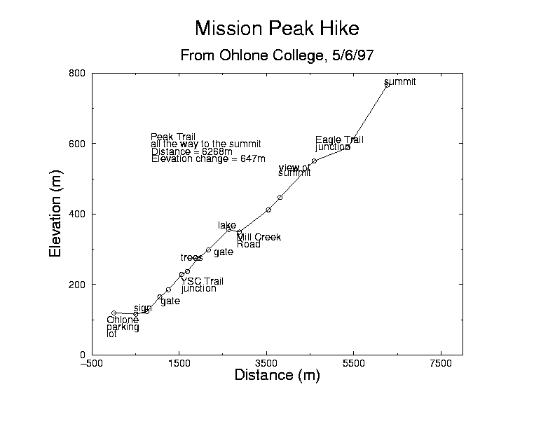
Click on the image for a large postscript version with better fonts (17K).
Photographic trail guide to the ascent.
The time for this hike was about 5½ hours, including lunch. Most of the hike takes place in the Mission Peak Regional Preserve, which is part of the East Bay Regional Park District.
This route is the easiest way to the top, being less steep than the Stanford Avenue version and shorter than the Sunol version. For some reason, there are signs posted saying that you can't park on the Ohlone campus on the weekend without a permit. Why not? Ohlone is a publicly funded institution and the lots are empty on weekends.